
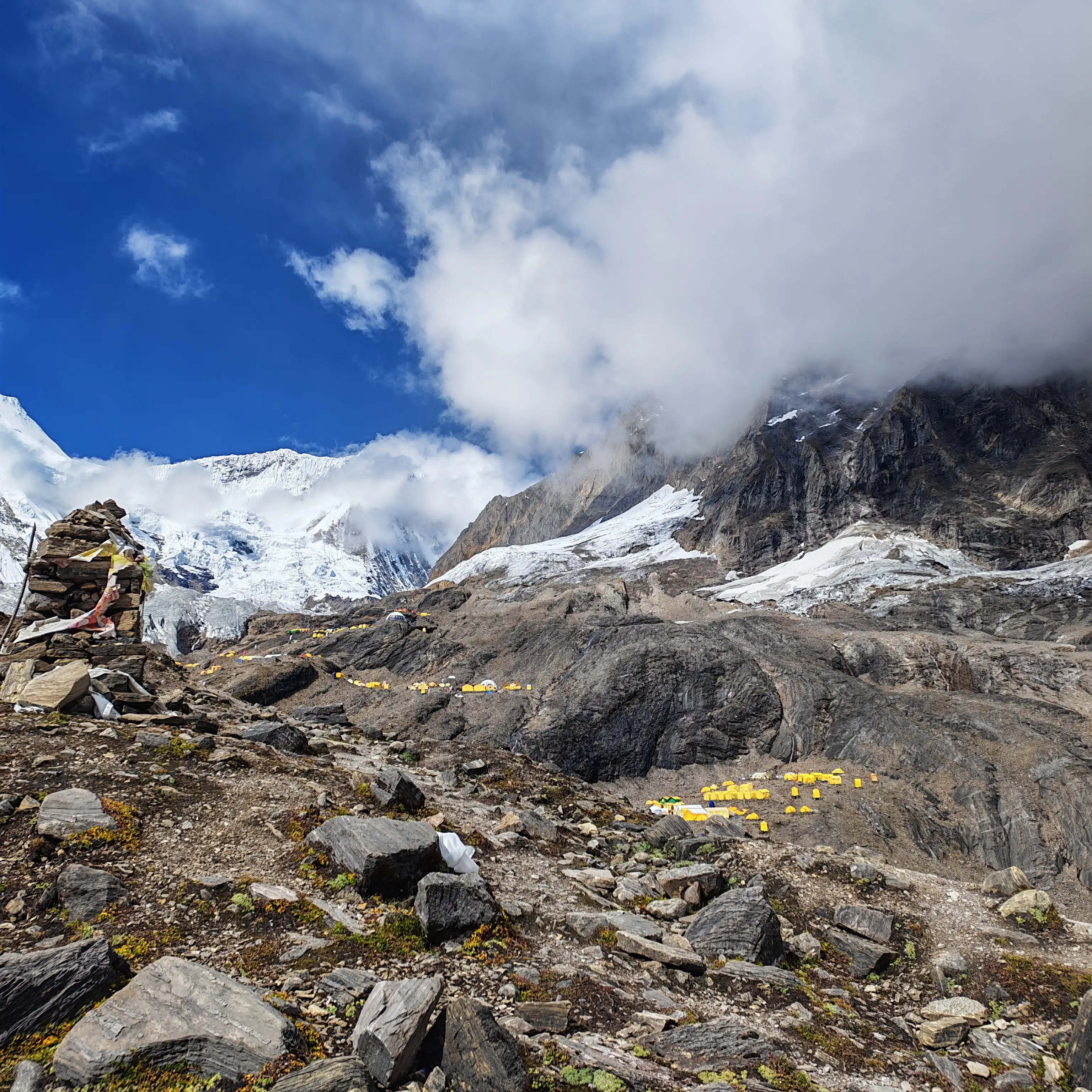
The Manaslu Circuit Trek distance covers approximately 177 kilometers (110 miles) of trekking trail, spread across 10 active trekking days plus acclimatization and travel days. When you factor in the drive from Kathmandu to the trailhead and back, the total journey spans around 13 days. This makes the trek one of Nepal's most rewarding and efficiently designed high-altitude treks.
Unlike many popular treks in Nepal, the Manaslu Circuit takes you deep into a restricted, culturally rich wilderness where the trails are quieter. The villages are more authentic, and the mountain views are amazing. You will see the world's eighth-highest peak, Mount Manaslu (8,163m), utterly breathtaking. Every kilometer of trail here tells a story of ancient Tibetan culture, towering gorges, alpine forests, and finally, the icy drama of Larkya La Pass (5,160m), the crowning achievement of the circuit.
This blog breaks down the complete Manaslu Circuit Trek distance day by day, giving you exact walking distances, elevation profiles, trail conditions, and everything you need to plan your trek with total confidence.
Quick Facts: Manaslu Circuit Trek at a Glance
| Detail | Information |
| Total Trek Distance | ~177 km (110 miles) |
| Total Trip Duration | 13 Days |
| Trek Start Point | Maccha Khola (870m) |
| Trek End Point | Gowa / Dharapani (1860m) |
| Highest Point | Larkya La Pass (5,160m) |
| Difficulty | Strenuous |
| Best Season | March–May & September–November |
| Permits Required | Restricted Area Permit + MCAP+ACAP+Local Area Permit |
| Trek Style | Teahouse Trek |
Manaslu Circuit Trek Distance Summary: Day-by-Day Table
| Day | Route | Distance | Duration | Altitude |
| Day 1 | Drive: Kathmandu → Maccha Khola | 180 km (road) | 9–12 hrs | 870m |
| Day 2 | Trek: Maccha Khola → Jagat | 22 km | 6–7 hrs | 1,340m |
| Day 3 | Trek: Jagat → Deng | 18 km | 6–7 hrs | 1,860m |
| Day 4 | Trek: Deng → Namrung | 16 km | 6–7 hrs | 2,630m |
| Day 5 | Trek: Namrung → Shyala | 14 km | 5–6 hrs | 3,500m |
| Day 6 | Trek: Shyala → Sama Gaun (+Pungyen Gumba) | 10 km (+4 side trip) | 7–8 hrs | 3,530m |
| Day 7 | Acclimatization: Sama Gaun (+optional Base Camp hike) | 0–14 km | Full day | 3,530–4,300m |
| Day 8 | Trek: Sama Gaun → Samdo | 8 km | 3–4 hrs | 3,860m |
| Day 9 | Trek: Samdo → Dharmasala | 8 km | 3–4 hrs | 4,460m |
| Day 10 | Trek: Dharmasala → Bimthang via Larkya La | 20 km | 9–10 hrs | 5,160m (pass) |
| Day 11 | Trek: Bimthang → Gowa | 14 km | 4–5 hrs | 2,550m |
| Day 12 | Trek: Gowa → Tilje + Drive to Besisahar | 5 km + 75 km road | 4 hrs total | 1,860m |
| Day 13 | Drive: Besisahar → Kathmandu | 175 km (road) | 5–7 hrs | 1,400m |
Total Trekking Distance (on foot): ~177 km
Total Road Journey: ~430 km
Why Manaslu Circuit Trek Distance Matters for Planning
Understanding the exact daily trekking distances on the Manaslu Circuit is critical for several reasons. First, the trek traverses restricted and remote territory; there are no helicopters on standby, and trail exits mid-route are extremely limited. Second, the dramatic altitude gain across 13 days demands proper pacing. Third, the terrain varies wildly: from flat riverside trails along the Budhi Gandaki to brutal rocky switchbacks leading to Larkya La Pass.
Knowing how far you walk each day allows you to:
- Pace your energy correctly and avoid overexertion
- Understand when acclimatization rest days are needed
- Set realistic expectations for daily start times and arrival at teahouses
- Plan your emergency buffer days intelligently
Now, let's walk through every single day of the Manaslu Circuit Trek, kilometer by kilometer.
Day 01: Drive from Kathmandu to Maccha Khola (870m)
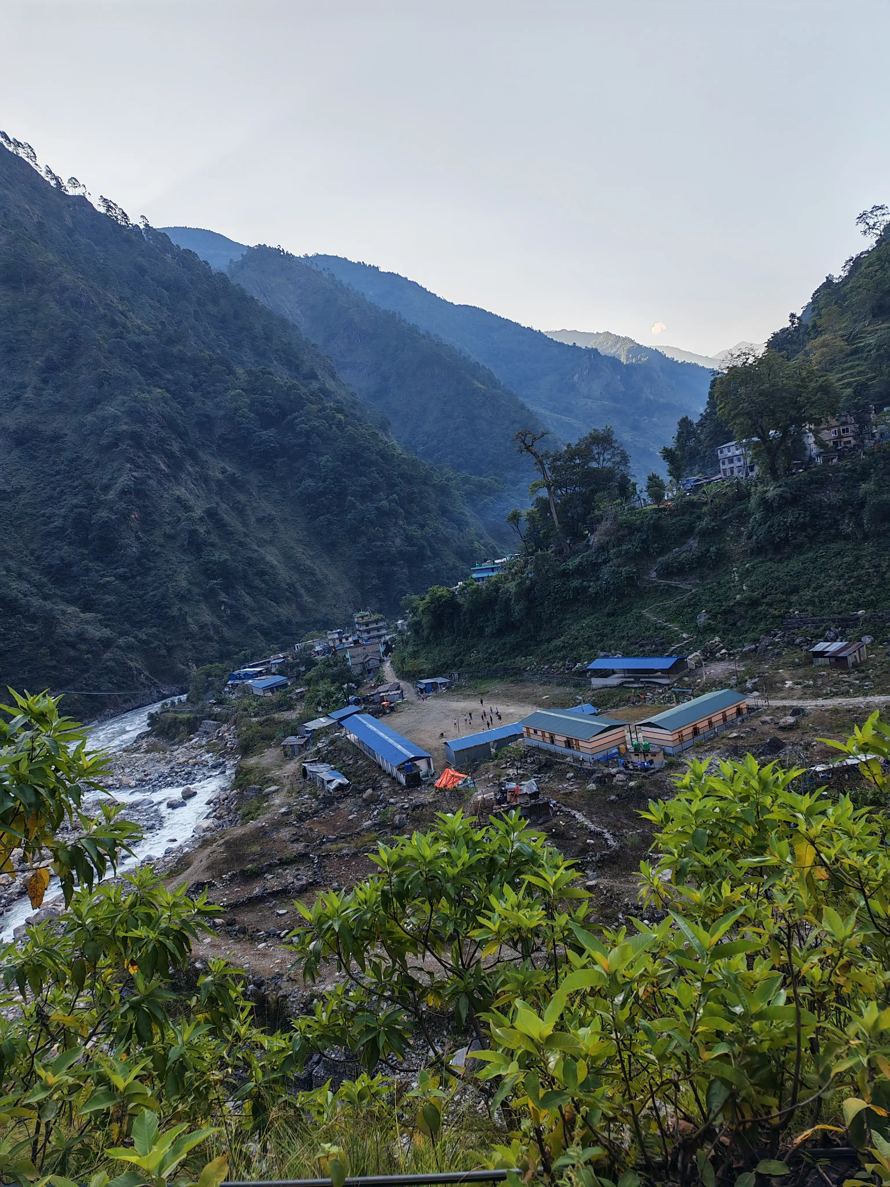
Distance: ~180 km by road | Duration: 9–12 hours | Altitude Gain: +0m (road journey)
The Manaslu Circuit Trek begins not with boots on a trail, but with wheels on a winding mountain road. From Kathmandu, you travel northwest toward Arughat and then continue to Maccha Khola, the official gateway to the trek. The drive covers approximately 180 kilometers by road, but do not let that number mislead you; Nepal's mountain roads are nothing like highways.
The journey winds through the mid-hills of the Gorkha district, past cascading rivers, terraced farmland, and traditional Nepali villages. You'll cross the Trishuli River and follow the Budhi Gandaki River upstream for much of the route. The road quality deteriorates significantly beyond Arughat, turning from tarmac to rough dirt track. Depending on the season, river crossings and landslide debris can slow progress further.
Maccha Khola (870m) is a small riverside settlement that serves as the last semi-developed town before entering the Manaslu Conservation Area. Most groups arrive in the evening and rest overnight in local teahouses, preparing their gear for the first day of real trekking ahead.
Tip: Depart Kathmandu very early (5:30–6:00 AM) to avoid traffic and maximize daylight for the rough final stretch of road.
Day 02: Trek from Maccha Khola to Jagat (1,340m)
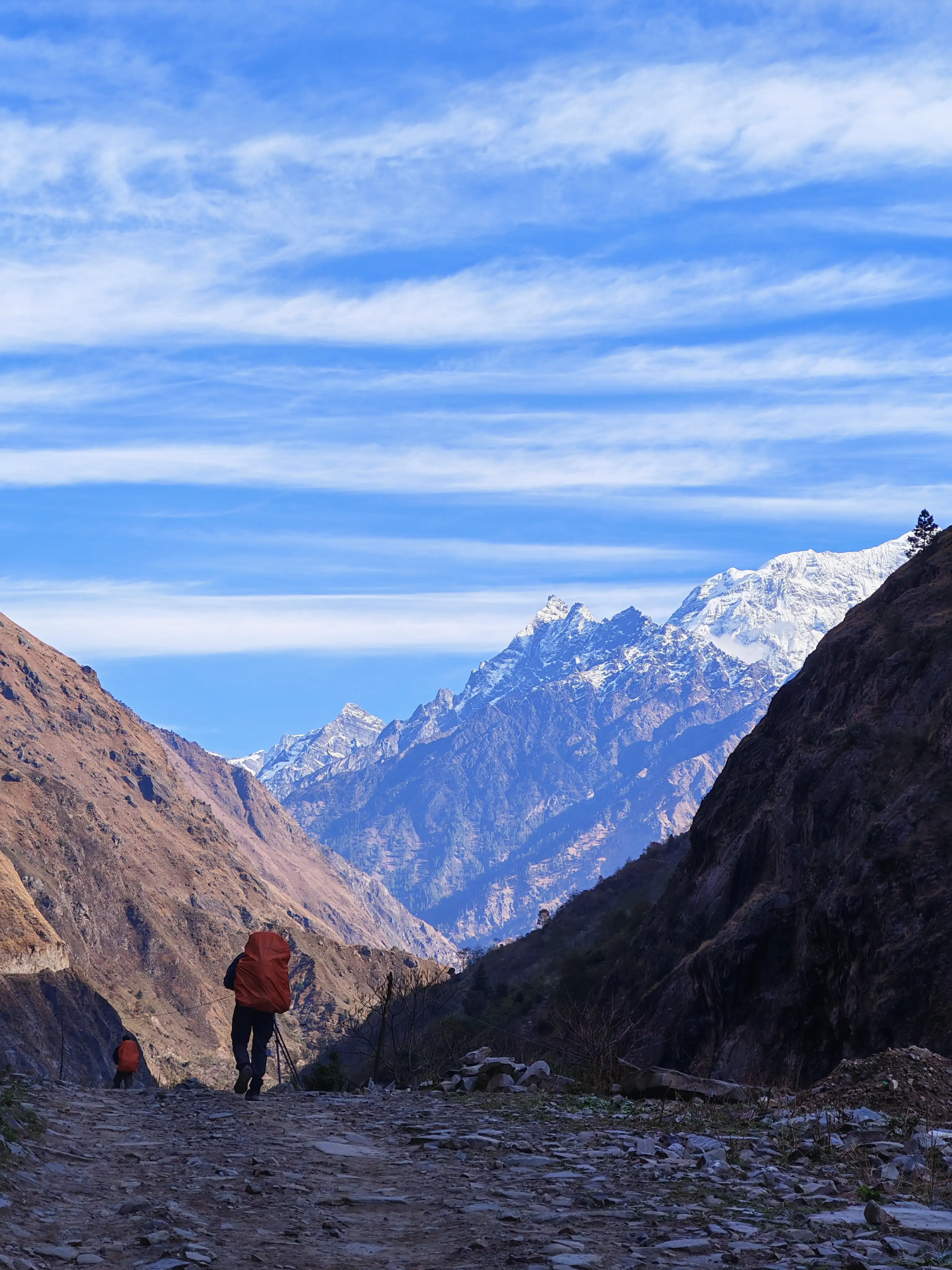
Distance: ~22 km | Duration: 6–7 hours | Altitude Gain: +470m
Today marks your first day on foot, and the trail immediately plunges you into the raw beauty of the Budhi Gandaki River gorge. Covering roughly 22 kilometers, this is one of the longer flat-to-gradual days of the entire circuit and a wonderful warm-up for what lies ahead.
From Maccha Khola, the trail follows the eastern bank of the Budhi Gandaki River through a sequence of subtropical forests, small farming villages, and dramatic river bends. The path crosses the river multiple times via suspension bridges, some wide and steel-reinforced, others older and rope-slung. Each crossing offers thrilling views of the churning grey-green water far below.
Key villages along today's route include Tatopani (famous for its hot springs) and Doban, a midpoint resting spot with simple tea stalls. As you approach Jagat (1,340m), you enter the official Manaslu Conservation Area (MCAP), where your permits will be checked at the entrance gate for the first time.
Jagat itself is a traditional stone-paved village with a number of well-run teahouses. The name "Jagat" means "the world" in Sanskrit, and it stands at the entrance of the Manaslu corridor. It does feel like you are standing at the threshold of another world entirely.
Cumulative distance from Maccha Khola: 22 km
Day 03: Trek from Jagat to Deng (1,860m)
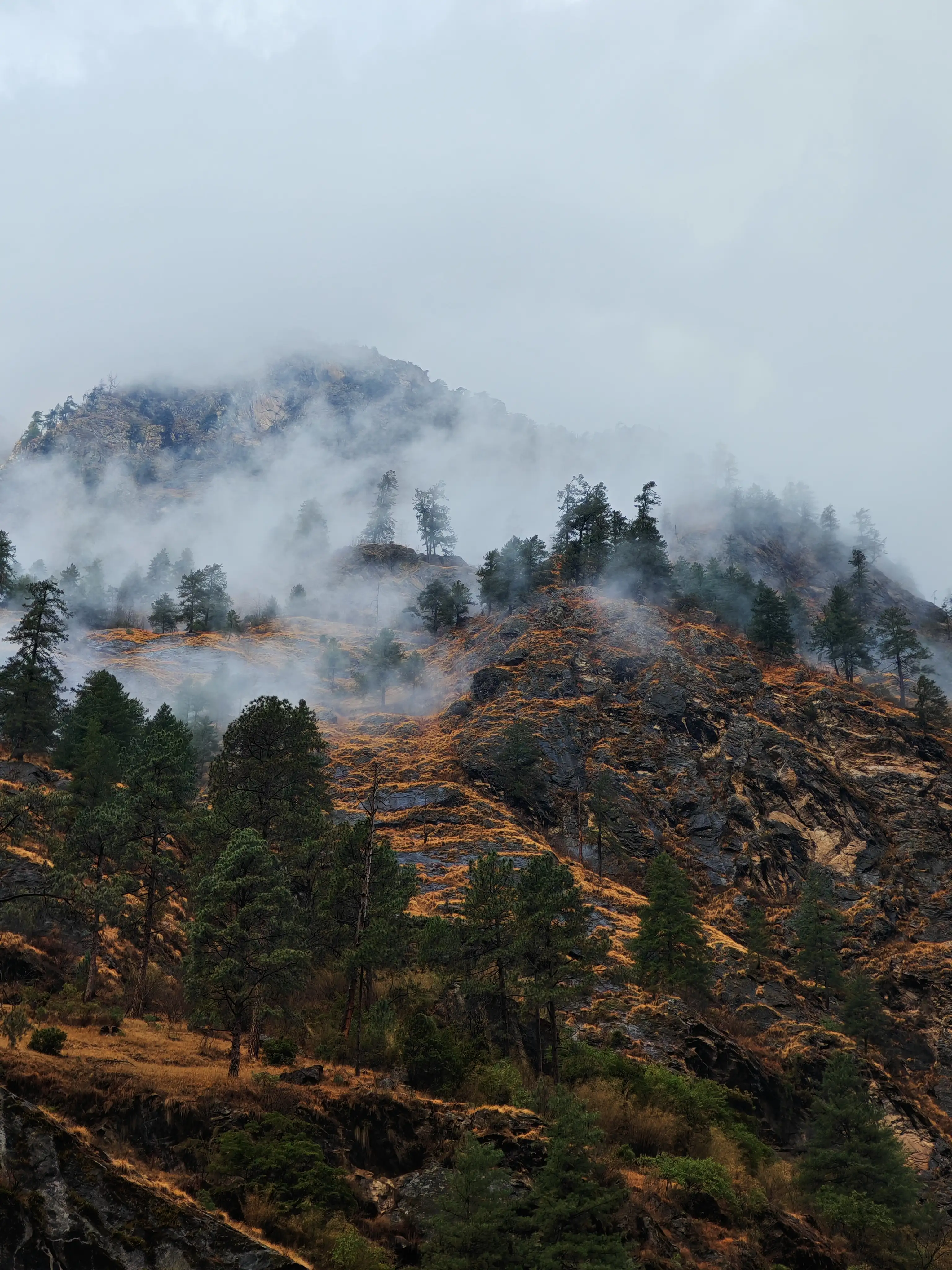
Distance: ~18 km | Duration: 6–7 hours | Altitude Gain: +520m
Today's trail deepens your entry into the Budhi Gandaki Gorge, one of the most dramatically narrow and steep river valleys in all of Nepal. The 18-kilometer route to Deng winds through a remarkable mix of dense bamboo forests, cascading waterfalls, and an almost constant series of suspension bridges.
From Jagat, the trail crosses to the western bank of the Budhi Gandaki and begins a series of up-and-down traversals along steep forested valley walls. You will pass through Salleri and Sirdibas, small clusters of houses where locals dry chilies on rooftops and mule trains regularly share the narrow path. The bamboo groves here are thick enough that on a misty morning, they create an atmospheric tunnel of green that stretches for hundreds of meters.
Shortly before Deng, the trail crosses back to the eastern bank via an impressive suspension bridge and begins a short ascent into the village. Deng (1,860m) is a modest but warm settlement; its teahouses are simple, but the views of the surrounding cliffs and river below are spectacular. This is also the last major settlement before the trail begins its more serious climb toward Tibetan cultural territory.
Trail Highlight: Keep your eyes on the cliffs above the river; Golden Langur monkeys and Himalayan Griffon vultures are frequently spotted along this section.
Cumulative distance from Maccha Khola: 40 km
Day 04: Trek from Deng to Namrung (2,630m)
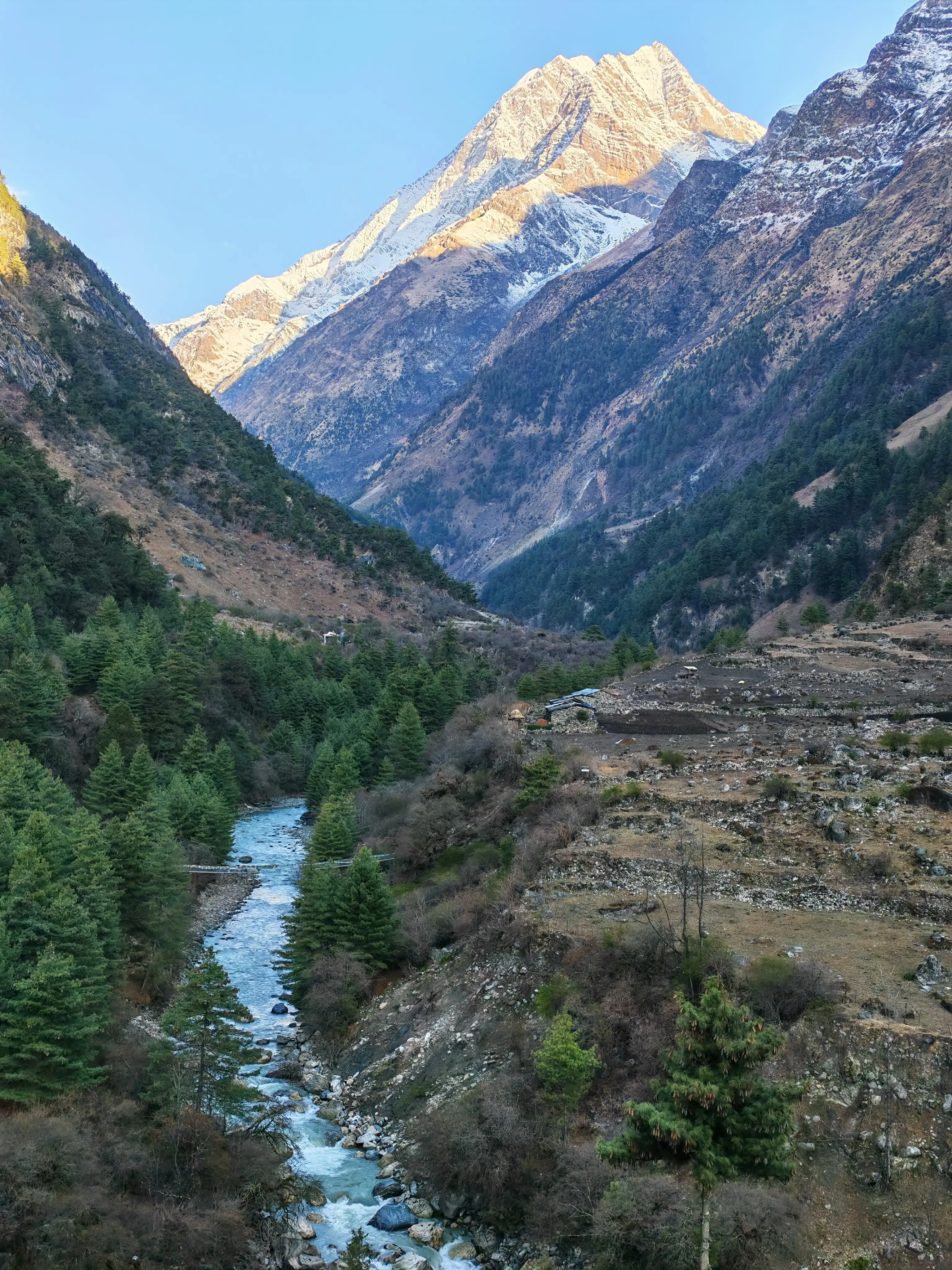
Distance: ~16 km | Duration: 6–7 hours | Altitude Gain: +770m
Today is when the Manaslu Circuit begins to transform. As you gain altitude on the 16-kilometer trail from Deng to Namrung (2,630m), the subtropical forests give way to temperate pine and oak forests. The air cools noticeably, and on a clear morning, the hulking white pyramid of Mount Manaslu makes its first grand appearance above the valley walls.
From Deng, the trail passes through Rana and Bihi. There are 2 villages with distinctly Tibetan architectural influences. The stone houses are decorated with carved wooden windows and Buddhist prayer flags. The valley gradually opens up here, and the gradient, while still a steady uphill, becomes more manageable on wider, rockier trails.
The final stretch into Namrung involves crossing back over the Budhi Gandaki once more and ascending a forested hillside. Namrung (2,630m) is a beautiful highland village positioned on a broad terrace with sweeping views of Siringi Himal and early glimpses of Ganesh Himal to the south. The teahouses here are among the best in this section of the valley, and the local stone architecture gives the village a genuinely remote, Himalayan feel.
Cumulative distance from Maccha Khola: 56 km
Day 05: Trek from Namrung to Shyala (3,500m)
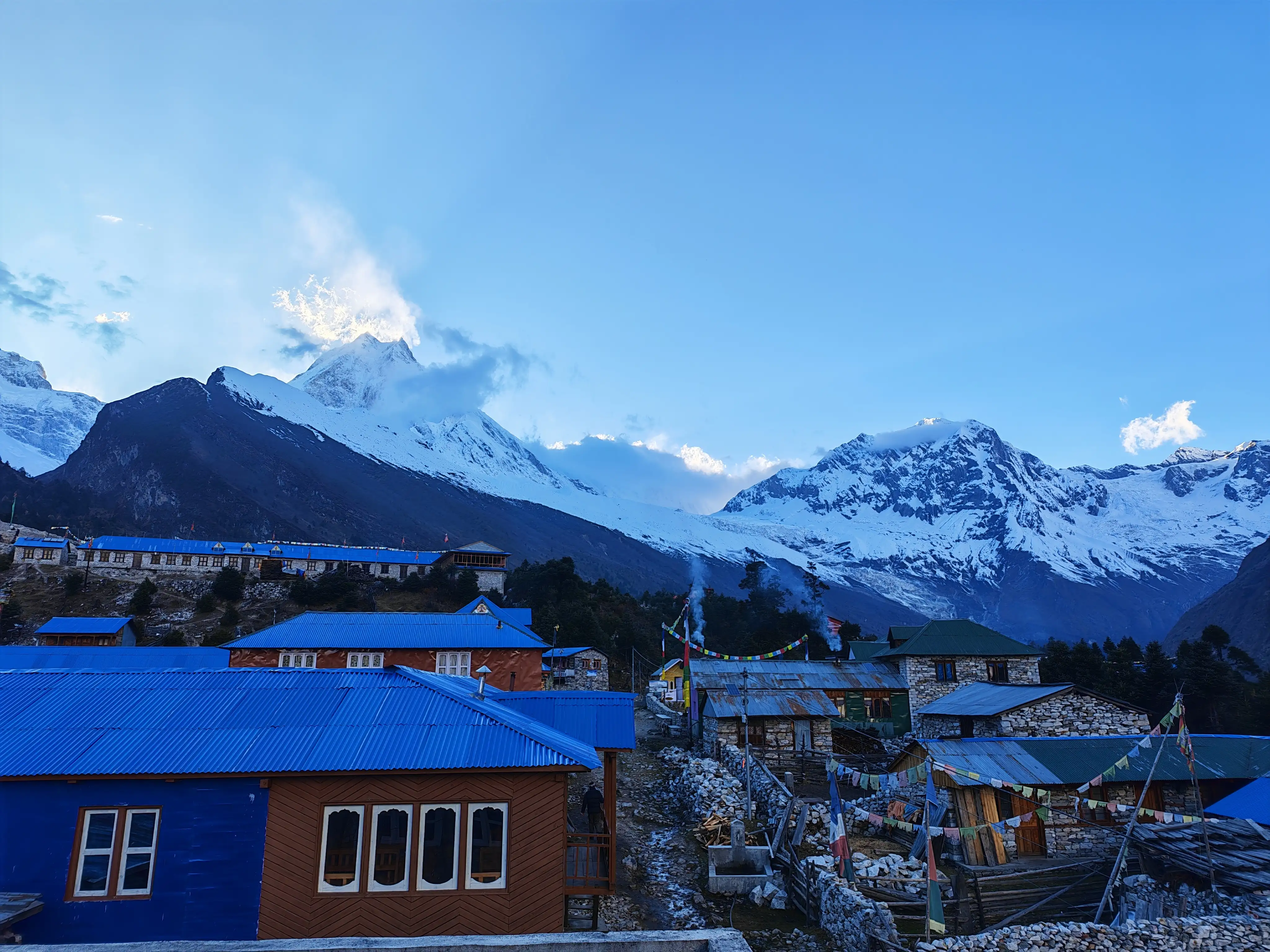
Distance: ~14 km | Duration: 5–6 hours | Altitude Gain: +870m
Today, the Manaslu Circuit enters full Tibetan Buddhist territory, and the cultural richness of this section is every bit as impressive as the mountain scenery. The 14-kilometer trail from Namrung to Shyala passes through some of the most scenically dramatic and spiritually charged villages on the entire circuit.
From Namrung, the trail climbs through Lihi and Sho villages. You will pass through mani walls (long stone walls engraved with Buddhist prayers), chortens (whitewashed stupas), and colorful prayer flags, which are ubiquitous features. The custom here, observed throughout Tibetan Buddhist culture, is to pass to the left of all mani walls and chortens as a mark of respect, a tradition you should honor.
The landscape opens up dramatically as you climb higher. The views of Manaslu (8,163m), Ngadi Chuli (7,871m), and Himal Chuli (7,893m) now dominate the skyline ahead, a wall of ice and rock that seems almost impossibly close. Just before Shyala, the trail passes through Lho. This village is one of the most photogenic villages of the circuit, where a large gompa (monastery) sits perched on a ridge above the houses.
Shyala (3,500m) is a small village with a handful of teahouses but extraordinary unobstructed views of Manaslu. On a clear evening, watching the last alpenglow paint the summit gold from the courtyard of a Shyala teahouse is genuinely among the finest mountain moments in Nepal.
Trail Highlight: Visit the monasteries at Lho Village; the resident monks are welcoming of respectful trekkers.
Cumulative distance from Maccha Khola: 70 km
Day 06: Trek from Shyala to Sama Gaun (3,530m)
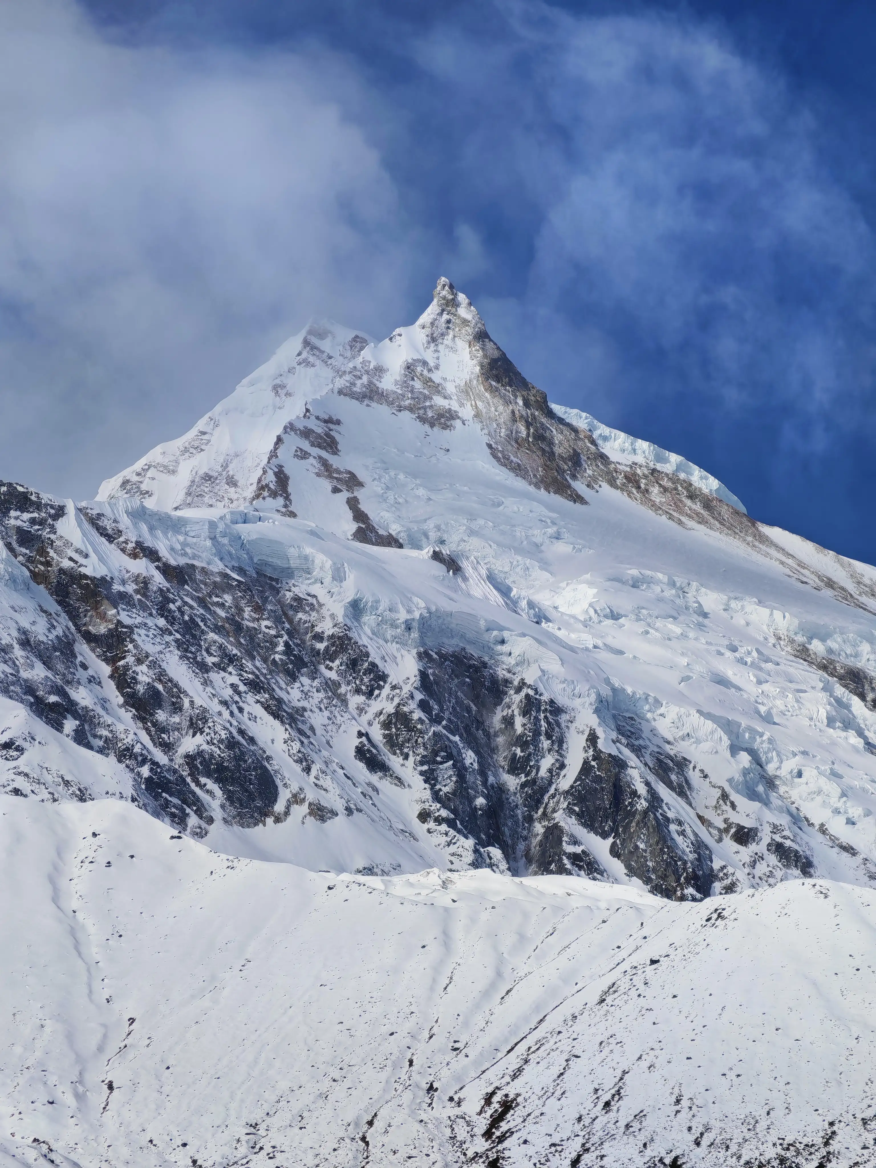
Distance: ~10 km | Duration: 7–8 hours including Pungyen Gumba side trip | Altitude Gain: +30m (with significant elevation variation)
Although today's direct trail distance between Shyala and Sama Gaun (3,530m) is only around 10 kilometers, this is one of the most culturally rewarding days of the entire Manaslu Circuit. The recommended side trip to Pungyen Gumba (4,000m) adds approximately 4–5 kilometers and 2 hours to the day, but it is an experience that should not be missed.
From Shyala, the main trail traverses the high plateau above the Budhi Gandaki gorge, through a landscape of alpine shrub and glacial moraines. The valley here has widened into a broad bowl ringed by glaciers and high ridges, a setting so expansive and otherworldly it can be hard to believe you are still in Nepal.
The detour to Pungyen Gumba climbs steeply from the main trail up to a dramatically perched monastery at 4,000m. The views from here, directly facing the entire Manaslu massif, are among the most spectacular in the Himalayas. The monastery itself is ancient, colorfully decorated, and still actively used by local monks.
Sama Gaun (3,530 m) is the largest village in the upper Budhi Gandaki valley. This is a proper Tibetan village with flagstone streets, stacked stone houses, a significant monastery, and the warm hospitality of the Nubri people. This is an excellent place to observe genuine Tibetan cultural life largely unchanged by modernity.
Cumulative distance from Maccha Khola: 80 km
Day 07: Acclimatization Day at Sama Gaun
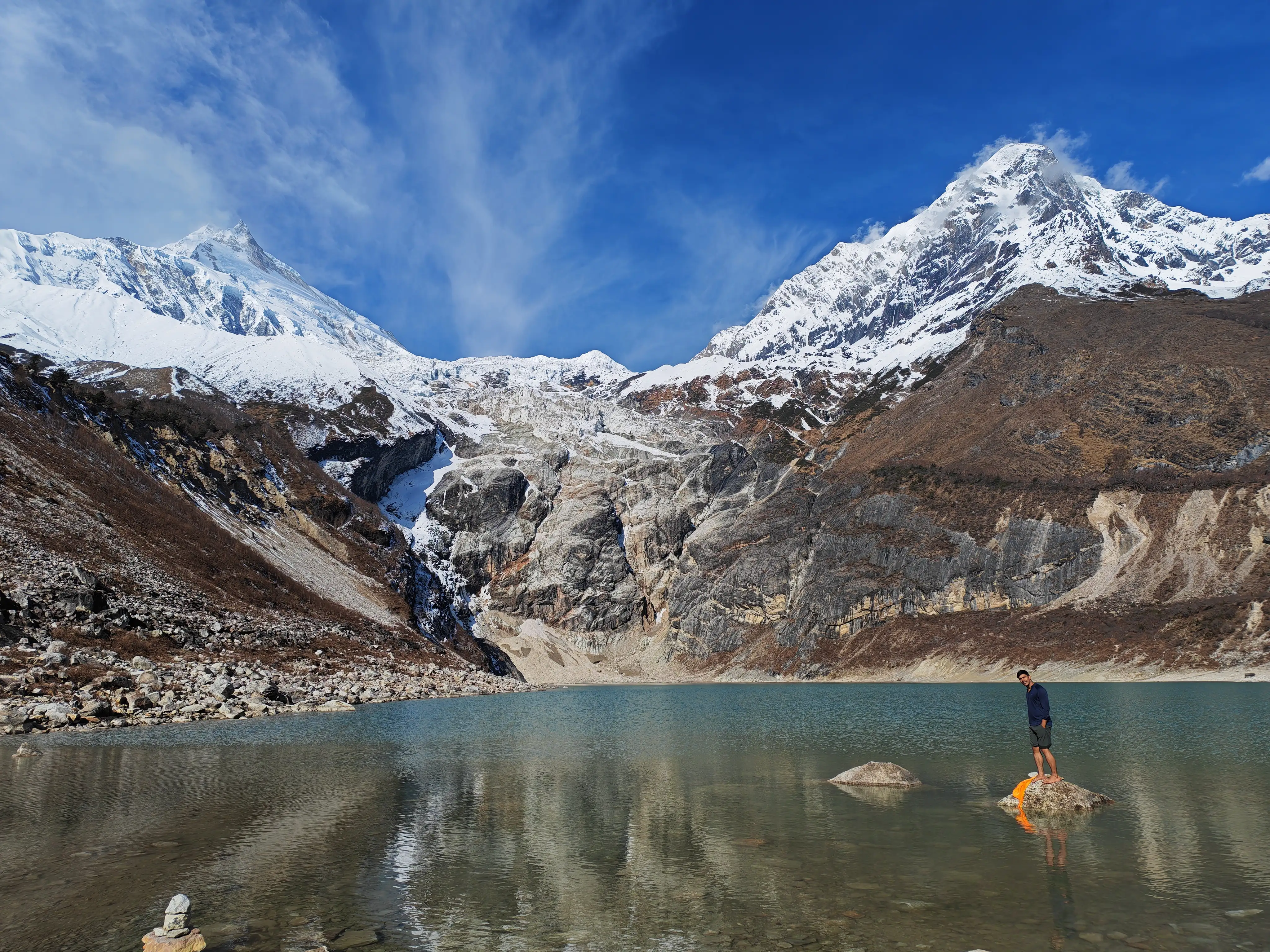
Distance: 0 km (rest) or 10–14 km (optional hike to Manaslu Base Camp) | Duration: All day if hiking to Base Camp | Altitude Gain: Up to +770m (to Base Camp at 4,300m)
Day 7 is a mandatory acclimatization rest day at Sama Gaun, and at 3,530m, your body genuinely needs it. The Larkya La Pass, still three days ahead, sits at 5,160m. Spending 24 hours at your current altitude allows your red blood cell count to increase and your body to adapt to reduced oxygen levels, dramatically reducing the risk of acute mountain sickness (AMS) on the pass.
The optional acclimatization hike to Manaslu Base Camp (4,300m) is highly recommended. The round trip covers approximately 10–14 kilometers and takes most of the day. From Sama Gaun, the trail climbs northeast through glacial moraines and across rocky terrain to the snout of the Manaslu Glacier. The base camp area offers close-up views of the Manaslu massif's southern face, a wall of ice and stone that climbers ascend via the difficult Northeast Ridge.
A shorter alternative is to hike to the beautiful Birendra Lake (3,450m), a glacially dammed turquoise lake sitting just above Sama Gaun, offering excellent Manaslu reflections on still mornings.
Whether you rest or hike, spend time in Sama Gaun itself: visit the gompa for morning prayers, chat with locals, and eat well. The days ahead are the most physically demanding of the entire circuit.
Altitude Warning: AMS symptoms, including headache, nausea, dizziness, and insomnia, should be taken seriously at this altitude. The golden rule: never ascend if you have symptoms. Descend immediately if they worsen.
Day 08: Trek from Sama Gaun to Samdo (3,860m)
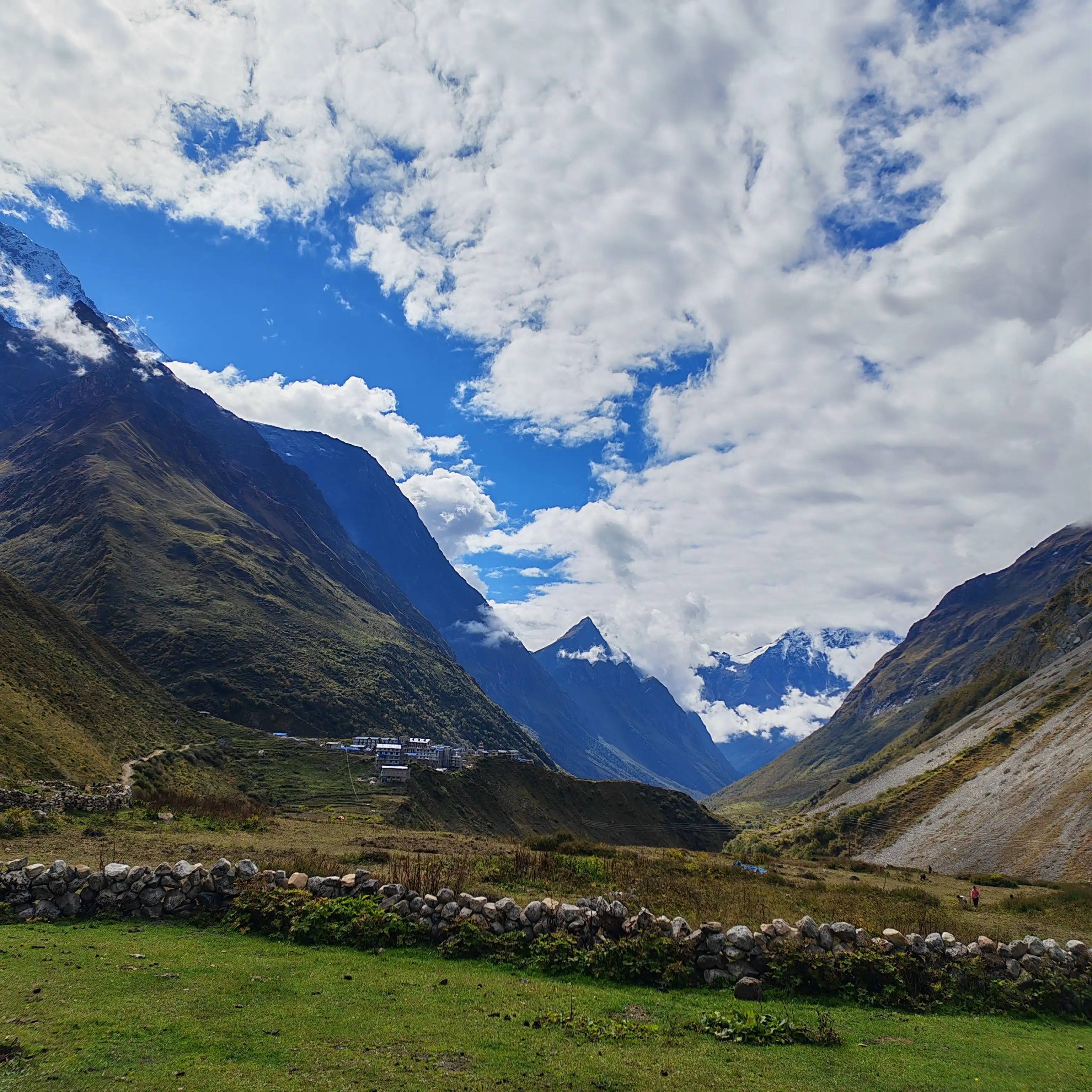
Distance: ~8 km | Duration: 3–4 hours | Altitude Gain: +330m
This is a deliberately short day, with just 8 kilometers, designed to aid continued acclimatization as you push higher into the Himalayan rain shadow. From Sama Gaun, the trail exits the village heading northwest and immediately enters an arid, treeless highland plateau that bears a striking resemblance to the Tibetan plateau.
The trail follows the Budhi Gandaki upstream, passing several ancient chortens and mani walls. The valley here is flat and wide, the air noticeably thinner, and on a calm morning, the silence is extraordinary. Silence is only broken by the distant rumble of glacial melt streams and the occasional bell of a passing mule caravan.
Samdo (3,860m) is a small but important village and also the last permanent settlement before the high-altitude approaches to Larkya La. Its population is primarily Tibetan, with many having historical connections to trade routes across the Larkya Pass into Tibet. You can clearly see the Tibetan border ridgeline from Samdo on a clear day, just a few kilometers to the north.
Teahouses here are comfortable by remote-trek standards. Use the afternoon wisely: eat a high-calorie dinner, hydrate aggressively, and go to bed early. The most demanding sections of the Manaslu Circuit Trek are now only two days away.
Cumulative distance from Maccha Khola: 88 km
Day 09: Trek from Samdo to Dharmasala / Larkya La Base Camp (4,460 m)
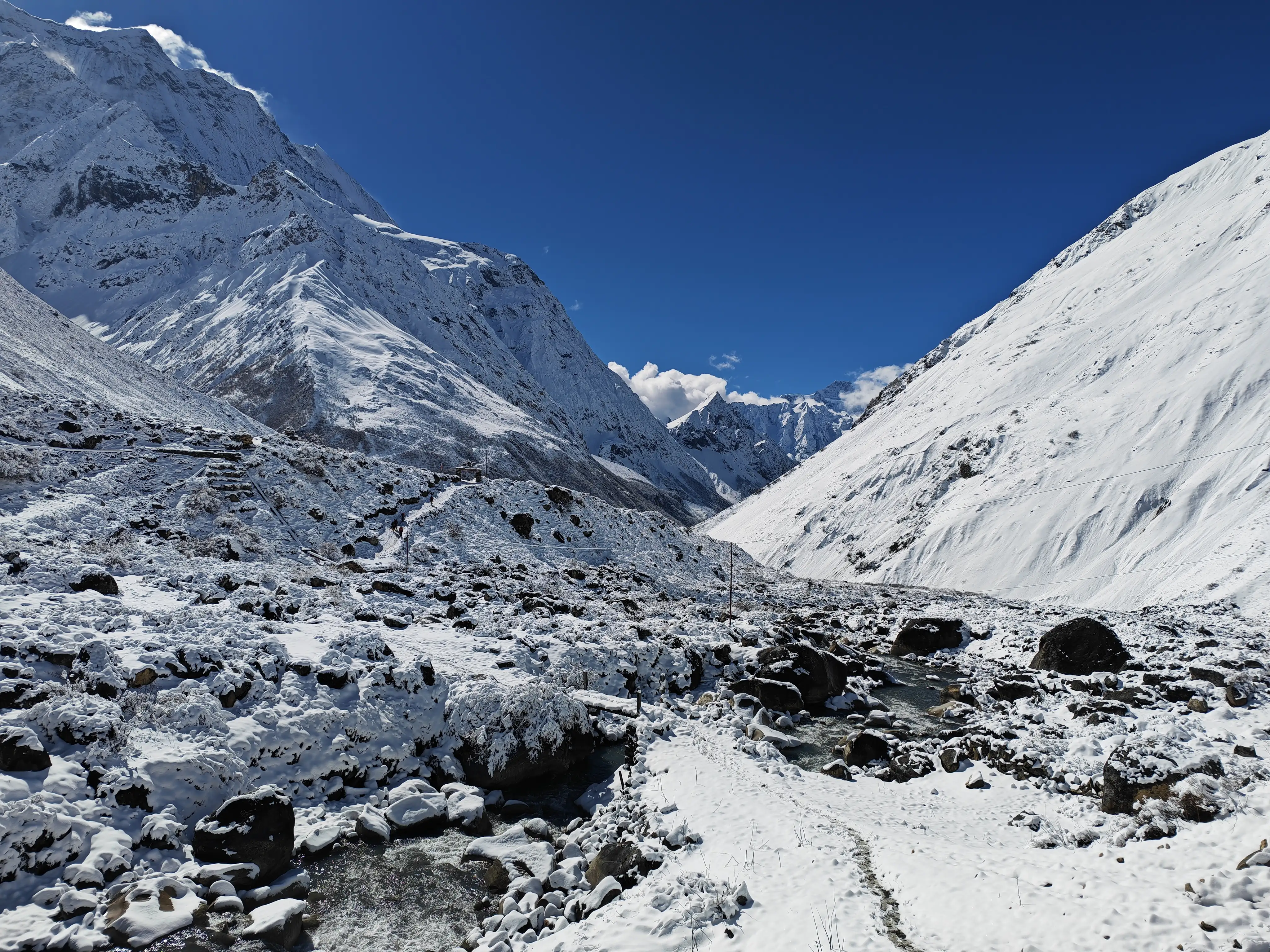
Distance: ~8 km | Duration: 3–4 hours | Altitude Gain: +600m
Another short but critical day. The 8-kilometer trail from Samdo to Dharmasala (4,460m), also known as Larkya La Base Camp, is a high-altitude approach hike. It is specifically designed to position trekkers for their pre-dawn assault on the pass the following morning.
From Samdo, the trail heads south and then west, crossing the Budhi Gandaki on a wooden bridge and beginning a long, gradual ascent across open meadows and rocky glacial terrain. There are no villages after Samdo, just trail markers, cairns, and the increasingly dramatic scenery of high-altitude Nepal. The final approach to Dharmasala involves a steeper climb through boulder fields.
Dharmasala (4,460m) is not really a village; it is a simple stone shelter and a handful of basic teahouses/lodges built specifically as a staging post for the Larkya La crossing. Electricity is minimal, menus are limited, and temperatures drop sharply after sundown. But the location is extraordinary: you are camped at the base of the Larkya Glacier with the pass looming directly above you.
Spend the afternoon preparing meticulously: check your equipment (gaiters, warm layers, headlamp, and spare batteries). Eat as much as you can manage, and aim to be in bed by 7:00–8:00 PM. Tomorrow's alarm will be set for 3:00–4:00 AM.
Cumulative distance from Maccha Khola: 96 km
Day 10: Trek from Dharmasala to Bimthang (3,720 m) via Larkya La Pass (5,160 m)
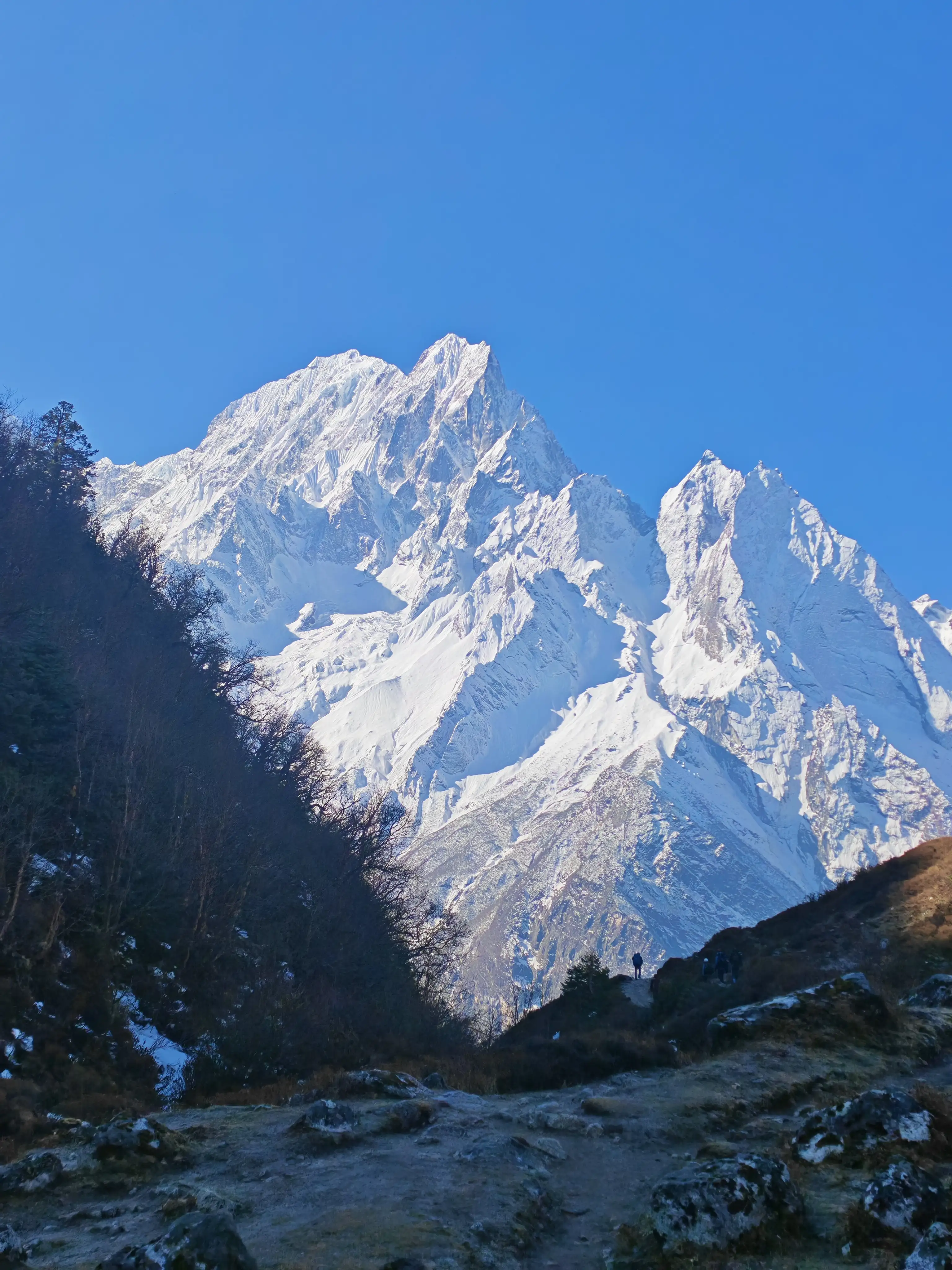
Distance: ~20 km | Duration: 9–10 hours | Altitude Gain: +700 m to pass, then -1,440 m descent | Highest Point: 5,160 m
This is the day the entire Manaslu Circuit builds toward. Today we will cross the longest, highest, and most dramatic day of the entire trek. We will cover approximately 20 kilometers and take 9–10 hours of near-continuous movement to the Larkya La Pass (5,160m).
Pre-dawn departure (3:00–4:00 AM) is standard practice for several important reasons: the snow on the pass is firmer and safer early in the morning before solar warming. There is also less risk of afternoon cloud buildup and potential snowfall. Arriving at the pass by sunrise gives you the best possible visibility and photography conditions.
The Climb to Larkya La (Dharmasala to Pass: ~6 km, 3–4 hours)
From Dharamsala, the trail initially follows a valley floor before beginning the long assault on the pass. In the pre-dawn darkness, your headlamp picks out the trail cairns and the footprints of other trekkers. The terrain transitions from rocky moraine to glacial ice and compacted snow. Many trekkers use trekking poles as essential tools here, not just for balance but for energy conservation on the 700m vertical climb.
As dawn breaks and you push above 5,000m, the views become spectacular. Annapurna range stretches across the southern horizon, Cheo Himal, Kang Guru, and Himlung Himal surround you, and beneath you, the Larkya Glacier glitters in the early light.
At Larkya La (5,160m), a cluster of prayer flags marks the summit of the pass. On a clear day, the 360-degree panorama includes some of the most extraordinary mountain scenery on earth. Take your time here, photograph the flags, and breathe deeply; you are standing at the highest point of the Manaslu Circuit Trek.
The Descent to Bimthang (Pass to Bimthang: ~14 km, 5–6 hours)
The descent from Larkya La is long and increasingly steep. The first section requires careful footwork on icy, snow-covered slopes. Follow your guide's lead and use your poles for stability. As the trail drops off the glacier, it transitions to rocky switchbacks, then to alpine meadows, and finally to the gentle upper valleys above Bimthang.
Bimthang (3,720m) feels like arriving in paradise after the demanding crossing. The village sits in a wide alpine bowl surrounded by Himalayan peaks, with Manaslu itself. Now it can be seen from the northwest, dominating the sky. The teahouses here are well-stocked, and the food is comforting. Most trekkers fall asleep early and sleep deeply.
Cumulative distance from Maccha Khola: 116 km
Day 11: Trek from Bimthang to Gowa (2,550m)
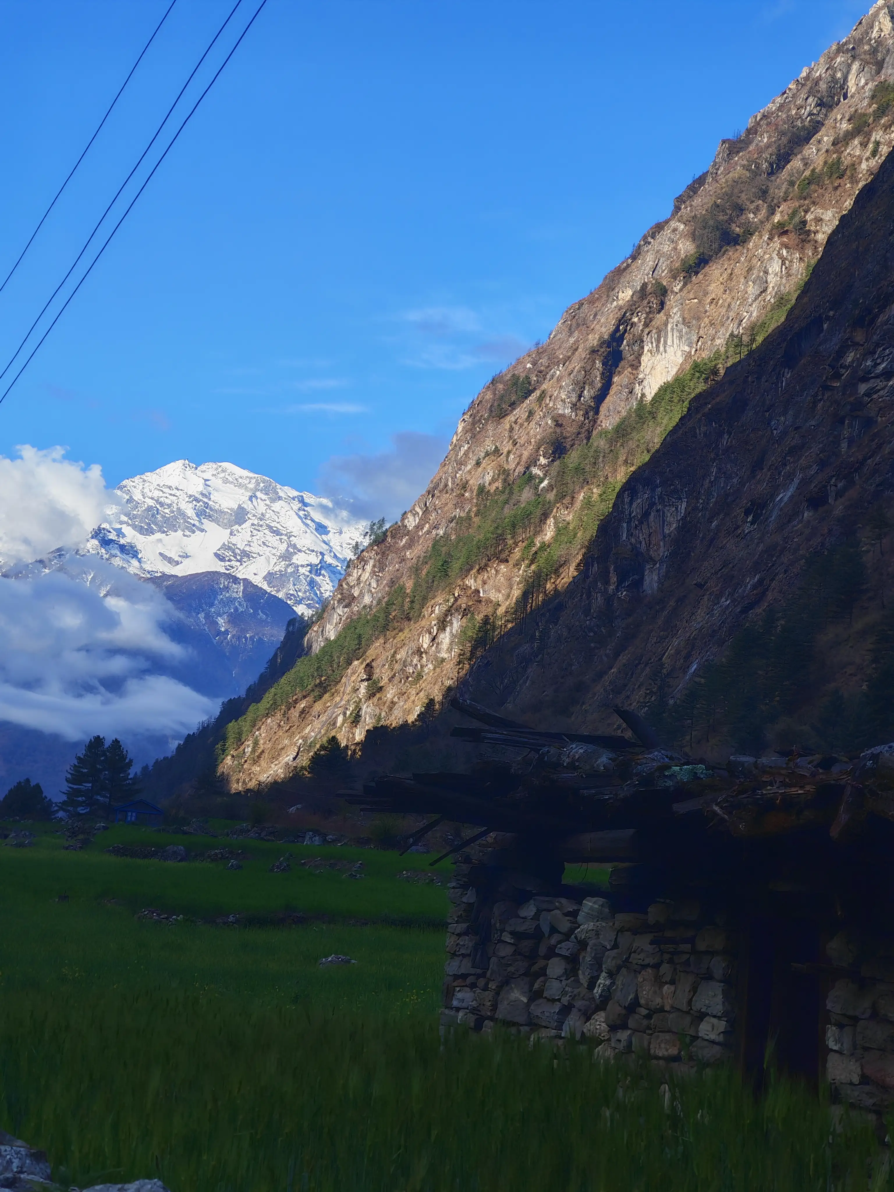
Distance: ~14 km | Duration: 4–5 hours | Altitude Loss: -1,170 m
After the exertions of Larkya La, Day 11 is a welcome relief, a short, mostly downhill trek of around 14 kilometers from Bimthang to Gowa. The descent takes you out of the high alpine zone and back into more temperate forest territory. A transition feels both physically easier and visually refreshing after days of ice and rock.
From Bimthang, the trail descends steeply at first through rhododendron and pine forest before easing into a more gradual downhill gradient along the Dudh Khola (Milk River) valley. The river earns its name from its milky-grey glacial meltwater, a striking sight against the green forest backdrop.
You will pass through Hampuk and cross several streams before reaching Gowa, also sometimes referred to as Gho on older maps. This tiny settlement is more a collection of a few teahouses than a village, but its location on a forest terrace with views back up toward the Manaslu massif makes it a fine overnight resting point.
The afternoon is yours to rest, tend to any blisters, and reflect on the extraordinary journey you have completed. The hardest and highest days are behind you.
Cumulative distance from Maccha Khola: 130 km
Day 12: Trek from Gowa to Tilje (1 hour), then drive to Besisahar (4 hours) (1,860 m)
Distance: ~5 km on foot | ~75 km by road | Duration: ~4 hours total
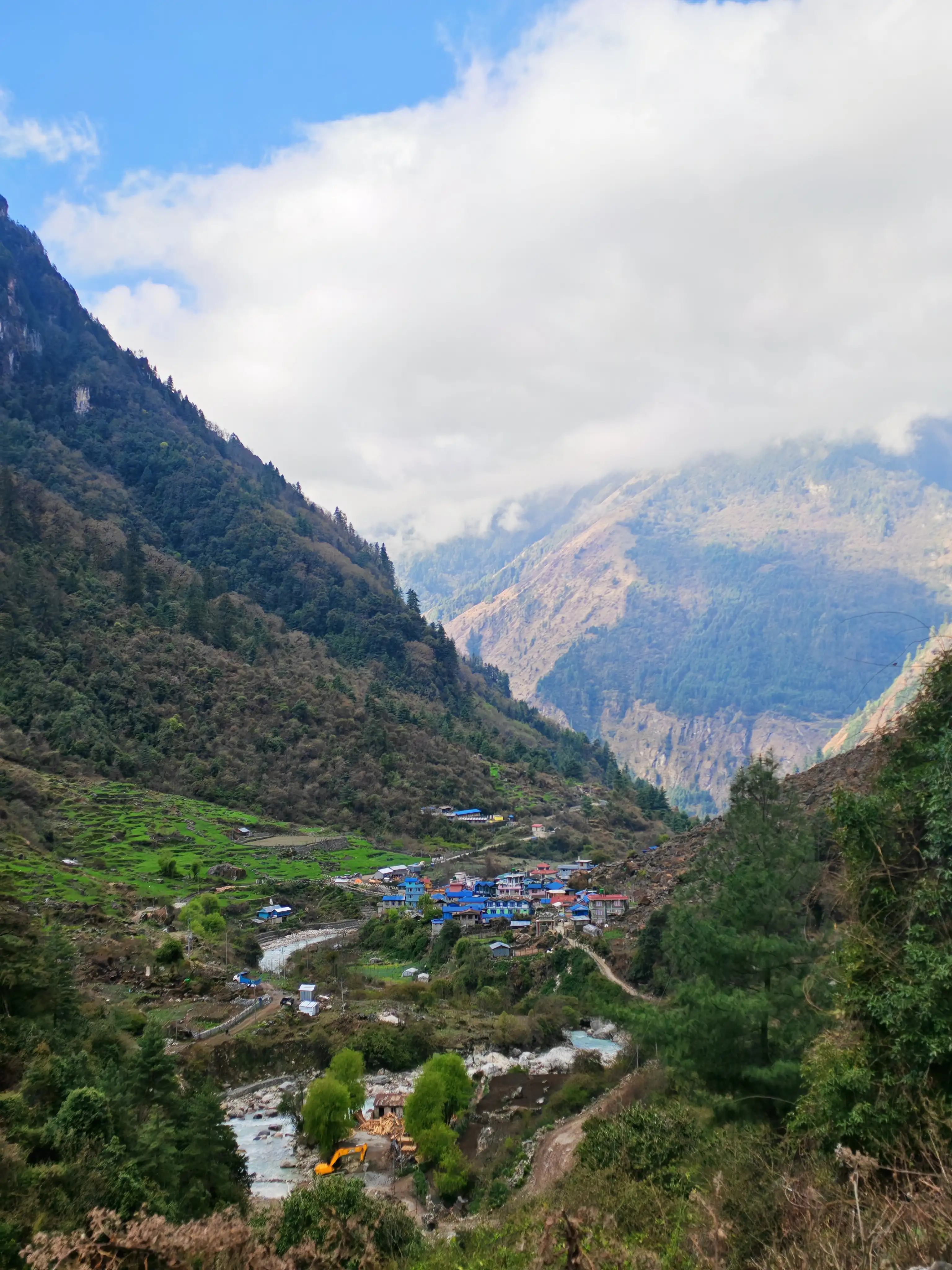
The final active day of the Manaslu Circuit combines a short 5-kilometer walk from Gowa to Tilje with a 3 to 4 hour road drive to Besisahar. It is the major hub of the Marsyangdi Valley and the start/end point for the Annapurna Circuit Trek.
The one-hour walk to Tilje passes through beautiful subtropical forest and terraced fields. It is a gentle, meditative finale to your trekking days. Tilje is a small village on the road that connects the upper Dudh Khola valley to the main Besisahar road, and from here, vehicles (typically jeeps) can pick you up for the onward drive.
The 75-kilometer road drive to Besisahar (1,860m) follows the Marsyangdi River downstream through some of Nepal's most fertile middle-hill country. This is the same valley that Annapurna Circuit trekkers enter from Besisahar heading north. So if you have done that trek previously, the scenery will feel familiar, but from a new angle. Besisahar is a well-developed town with proper restaurants, lodges, and excellent mobile connectivity, a welcome return to civilization.
Total Manaslu Circuit Trek Distance Covered on Foot: ~177 km
Day 13: Drive from Besisahar to Kathmandu
Distance: ~175 km by road | Duration: 5–7 hours
The final journey of the Manaslu Circuit takes you on the approximately 175-kilometer road drive from Besisahar back to Kathmandu. The route follows the Trishuli River valley and the main Prithvi Highway, Nepal's primary east-west artery connecting the hills to the capital.
Unlike the rough dirt tracks of Day 1, the Besisahar-to-Kathmandu road is well-maintained and largely tarmacked, cutting the journey to a comfortable 5–7 hours. You will arrive back in Kathmandu in the afternoon, carrying with you 13 days of memories: the roar of the Budhi Gandaki, the prayer flags of Namrung, the glaciers, and the triumph of Larkya La Pass.
Manaslu Circuit Trek Elevation Profile
Understanding the altitude gain and loss across the circuit helps you appreciate the physical demands:
- Days 1–5 (870m → 3,500m): Steady, manageable ascent through subtropical and temperate zones
- Days 6–9 (3,530m → 4,460m): High-altitude build-up with mandatory acclimatization
- Day 10 (4,460m → 5,160m → 3,720m): The biggest altitude swing of the trek, 700m up, then 1,440m down
- Days 11–12 (3,720m → 1,860m): Long, rewarding descent back to the midland valleys
The key elevation challenge is the sustained time above 3,500m (Days 5–10), during which proper acclimatization, hydration, and pacing are critical.
Permits Required for the Manaslu Circuit Trek
The Manaslu Circuit passes through a Restricted Area, which means special permits are mandatory. They can only be obtained through a registered trekking agency with a licensed guide.
- Manaslu Restricted Area Permit (MRAP)
- Cost: USD 100 per person per week (September–November), USD 75 per person per week (other months)
- Required for: All trekkers entering the Manaslu Conservation Area above Jagat
- Manaslu Conservation Area Permit (MCAP)
- Cost: NPR 3,000 per person (~USD 22)
- Required for: Entry into the Manaslu Conservation Area
- Annapurna Conservation Area Permit (ACAP)
- Cost: NPR 3,000 per person (~USD 22)
- Required for: The Bimthang-to-Besisahar section as you exit through the Annapurna region
Important: Solo trekking is not permitted on the Manaslu Circuit. You must be accompanied by a licensed trekking guide at all times within the restricted area.
Best Time to Trek the Manaslu Circuit
Spring (March–May): The most popular season. Rhododendron forests bloom in spectacular red and pink along the lower trails. Skies are generally clear, temperatures are moderate at altitude, and trail conditions are excellent. Larkya La Pass is typically snow-free or lightly dusted.
Autumn (September–November): The second major trekking window, following the monsoon season. Post-monsoon skies are crystal clear, offering the best mountain visibility of the year. Temperatures drop in October–November, particularly at high camps and on the pass.
Winter (December–February): Not recommended for most trekkers. Larkya La is frequently buried under deep snow and may be impassable. Temperatures at Dharmasala can drop to -20°C or below.
Monsoon (June–August): The trail is passable but very wet. Leeches are prevalent at lower elevations, trail washouts are common, and mountain views are frequently obscured by cloud.
Physical Fitness Requirements for the Manaslu Circuit
The Manaslu Circuit Trek is graded as strenuous, which is suitable for those with prior high-altitude experience and good physical fitness. Day 10 (Larkya La crossing) involves 9–10 hours of walking, including a high-altitude, pre-dawn start in potentially cold, icy conditions. The following preparation is recommended:
- Prior trekking experience at altitude (above 3,500m)
- Regular cardiovascular fitness training (running, cycling, stair climbing) in the months before departure
- Strength training for legs and core
- Experience using trekking poles on steep, uneven terrain
- Familiarity with altitude sickness symptoms and response protocols
First-time trekkers without prior altitude experience are strongly advised to consider a guided agency package with an experienced high-altitude guide and an appropriate acclimatization schedule.
Accommodation and Food Along the Manaslu Circuit
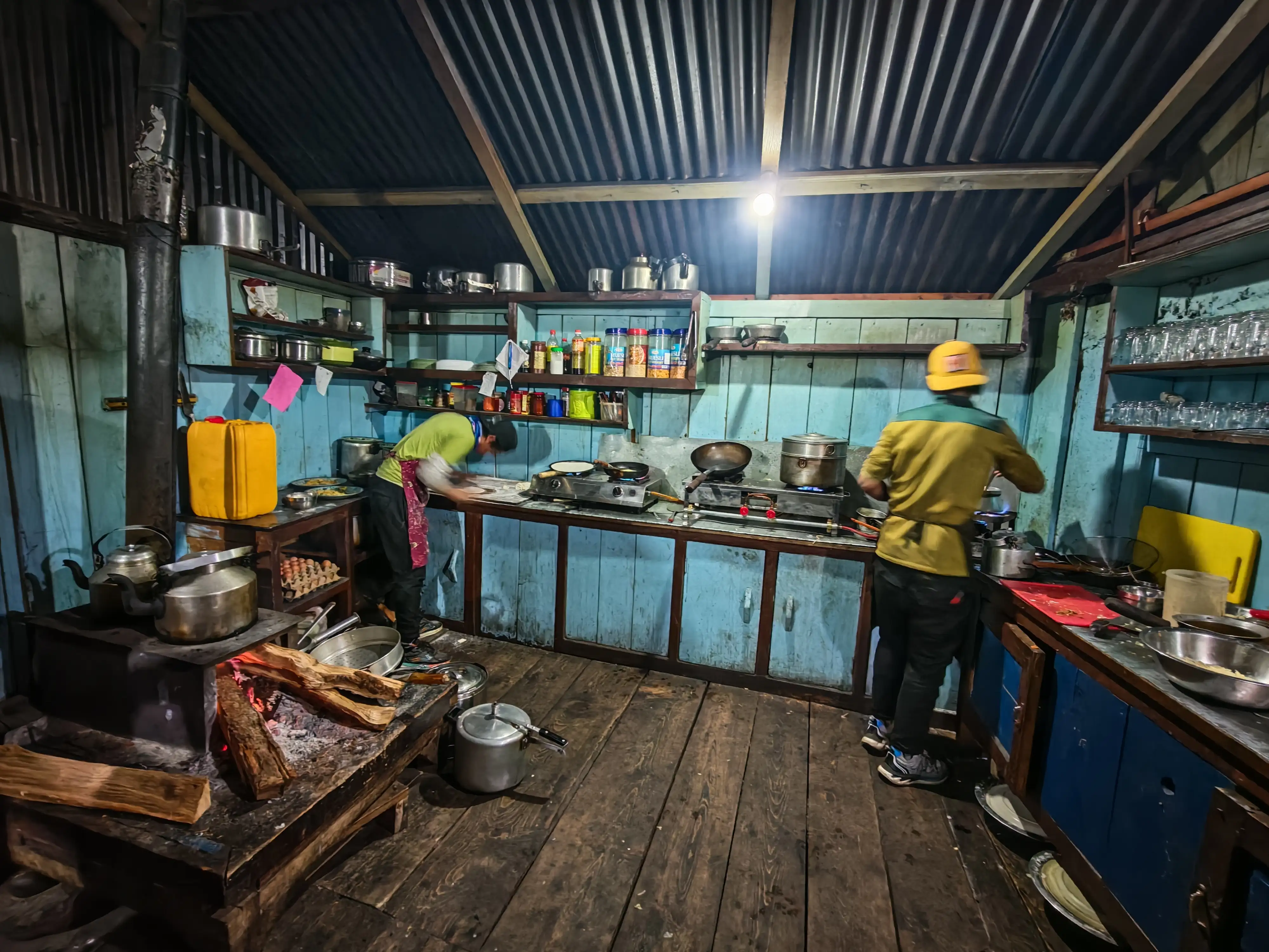
Unlike the heavily commercialized Everest or Annapurna circuits, the Manaslu Circuit's teahouse infrastructure is simpler and more authentic. Here is what to expect:
Lower sections (Maccha Khola–Deng): Basic teahouses with private or dormitory rooms, shared bathrooms (squat toilets common), simple meals of dal bhat, noodles, and eggs. Electricity is available for charging.
Middle sections (Namrung–Sama Gaun): Teahouses improve; some offer attached bathrooms and better-insulated rooms. Dal bhat remains the staple, supplemented by pasta, fried rice, and Tibetan bread. Solar charging is widely available.
High sections (Samdo–Dharmasala): Very basic lodges with limited menus and dormitory-style sleeping. Bring a quality sleeping bag rated to at least -10°C.
Post-pass sections (Bimthang–Gowa): Comfortable teahouses with good food. A celebratory meal and a warm bed feel enormously satisfying after Larkya La.
Packing Essentials for the Manaslu Circuit Trek
Given the remote nature of the trek and the demands of Larkya La Pass, your packing list should include:
- Sleeping bag rated to -10°C or below
- Down jacket and insulated mid-layer
- Waterproof outer shell (jacket and pants)
- Thermal base layers (top and bottom)
- Trekking poles (essential for the pass crossing)
- Headlamp with extra batteries (mandatory for pre-dawn pass start)
- Gaiters (for snow on and near the pass)
- High-quality trekking boots (waterproof, ankle support)
- Sun protection (sunglasses rated UV400+, SPF 50+ sunscreen, lip balm)
- Personal first aid kit, including altitude sickness medication (Diamox)
- Water purification tablets or a filter
- Sufficient Nepali Rupees cash (no ATMs above Philim)
Frequently Asked Questions About Manaslu Circuit Trek Distance
How long is the Manaslu Circuit Trek in kilometers?
The total trekking distance of the Manaslu Circuit is approximately 177 kilometers (110 miles) across 10 active trekking days, covering terrain from 870m at Maccha Khola to 5,160m at Larkya La Pass.
How many days does the Manaslu Circuit Trek take?
The standard itinerary takes 13 days, including drive days, 1 acclimatization day, and 10 trekking days. Shorter 11-day and longer 16–17-day variations also exist, depending on starting and ending points.
What is the highest point of the Manaslu Circuit Trek?
The highest point is Larkya La Pass at 5,160 meters (16,929 feet), crossed on Day 10 of the standard itinerary.
Is the Manaslu Circuit Trek harder than the Everest Base Camp?
Yes, generally. The Manaslu Circuit involves more days, a higher pass crossing, more remote trails, and greater day-to-day elevation variation than the standard Everest Base Camp trek.
Can I do the Manaslu Circuit Trek without a guide?
No. Solo trekking is not permitted in the Manaslu Restricted Area. All trekkers must be accompanied by a licensed guide registered with a recognized trekking agency.
What is the best season for the Manaslu Circuit Trek?
Spring (March–May) and Autumn (September–November) are the best seasons, offering the most stable weather, clearest mountain views, and safest conditions on Larkya La Pass.
Final Thoughts: Why the Manaslu Circuit Trek Distance Is Worth Every Step
The 177 kilometers of the Manaslu Circuit Trek are not just distance; they are a journey through time, culture, and landscape that few places on earth can rival. From the humid subtropical gorges of the Budhi Gandaki to the windswept high-altitude plateau approaching Larkya La, every day delivers something new, something remarkable, something unforgettable.
Unlike its more crowded Himalayan neighbors, the Manaslu Circuit rewards you with genuine remoteness and solitude. You will walk for hours seeing no one. You will sit in monastery courtyards with monks who have never seen the internet. You will cross a 5,160m pass in the pre-dawn dark and watch the Himalayan sunrise from the roof of the world.
If you are looking for a trek that is challenging, deeply authentic, strikingly beautiful, and genuinely life-changing, the Manaslu Circuit Trek deserves to be at the very top of your list.